← Home · Slopes & Walls

Slope Stability Analysis Canberra: Geotechnical Assessment for the Capital Region

Together, we solve the challenges of tomorrow.

EXPLORE →

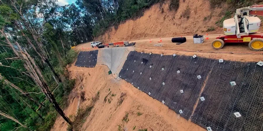
The geology shifts dramatically between Civic and the Molonglo Valley. In Civic, deep excavations hit the Canberra Formation—interbedded sandstone and mudstone that weathers to a stiff clay. Factor of safety drops fast in that material after heavy rain. Across the Molonglo corridor, thick colluvial deposits overlie deeply weathered rhyodacite. Slopes there fail as shallow translational slides. Our analysis maps these two failure modes separately. The same approach won’t work for both. We combine site investigation boreholes with targeted lab testing to define the shear strength envelope for each geological unit. Detailed investigation distinguishes a safe cut from a liability. The ACT’s average annual rainfall of 620 mm concentrates in intense summer storms. That stormwater infiltration pattern controls the critical pore pressure scenario used in every Canberra slope stability model. Our engineers apply triaxial testing to measure effective stress parameters rather than relying on conservative published correlations.

Canberra’s interbedded Canberra Formation creates perched water tables that demand transient seepage models, not steady-state assumptions.

Method and coverage

AS 4678:2002 governs earth retaining structures and slope works across Australia. In Canberra, its application is shaped by the ACT Territory Plan and the distinctive weathering profiles of the Lachlan Fold Belt. Rock mass here grades from fresh material to residual soil over short vertical distances. We see this on every hillside cut in suburbs like Aranda and Cook. A proper analysis must define the groundwater regime. Canberra’s perched water tables in weathered bedrock zones create pore pressure spikes that catch engineers off guard. Our methodology couples AS 1726 site investigation standards with limit equilibrium methods—Bishop, Spencer, and Morgenstern-Price—selected case by case. The geotechnical model integrates the following critical inputs: Output is a calibrated factor of safety envelope. We deliver this as a contour plot showing stable, marginal, and unstable zones across the full slope face.
Slope Stability Analysis Canberra: Geotechnical Assessment for the Capital Region
Technical reference image — Canberra

Regional considerations

A 15-metre cut was opened for a residential development on the slopes of O’Malley. The design assumed a uniform weathered mudstone profile using SPT blow counts. After the first summer storm, a tension crack opened 3 metres behind the crest. The slope hadn’t failed, but it was moving. The investigation had missed a thin, polished shear plane in the underlying siltstone—a relict structure from the Silurian deformation. The residual friction angle along that surface was 12° lower than the intact material. The original factor of safety of 1.6 dropped to 0.95 when modeled correctly. Remediation required soil anchors and a regraded profile. This is not an unusual scenario in Canberra. The Canberra Formation’s tectonic history leaves pervasive joint sets and thin clay seams that control stability more than the rock matrix. Ignoring structural geology in a city built on folded Paleozoic bedrock is a recurring failure mode. Our analysis always includes a structural domain assessment before any limit equilibrium calculation begins.

Need a geotechnical assessment?

Reply within 24h.

Email: contact@geotechnicalengineering1.co

Technical parameters

ParameterTypical value
Analysis methodLimit equilibrium (Bishop, Spencer, Morgenstern-Price); finite element where warranted
Design standardAS 4678:2002, AS 1726:2017, AS/NZS 1170.4:2007
Factor of safety (long-term)1.5 (static); 1.1–1.2 (pseudo-static seismic)
Shear strength inputEffective stress parameters (c’, φ’) from CIU or CID triaxial
Groundwater modelTransient seepage analysis for perched aquifers in weathered rock
Failure modes assessedCircular, planar (rock defects), wedge, compound
Seismic coefficient (kh)0.08–0.12 for Canberra hazard factor Z=0.08–0.11 per AS 1170.4
DeliverableStability contour map with FoS envelopes, cross-sections, remediation options

Complementary services

01

Geotechnical slope modelling

Development of a detailed geological model from borehole logging, geophysics, and structural mapping. Defines material zones, groundwater compartments, and critical defect orientations for the Canberra Formation or colluvial mantle.

02

Limit equilibrium and FE analysis

Stability calculations using Bishop, Spencer, or Morgenstern-Price methods for rotational and planar failures. Finite element modelling applied where progressive failure or strain-softening in stiff Canberra clays is a concern.

03

Remediation design and peer review

Design of soil nail arrays, rock anchors, drainage measures, or regrading profiles to achieve the target FoS. Independent peer review of third-party stability designs for ACT planning approval submissions.

Standards that apply

AS 4678:2002 Earth-retaining structures, AS 1726:2017 Geotechnical site investigations, AS/NZS 1170.4:2007 Structural design actions – Earthquake actions in Australia, ACT Territory Plan – geotechnical reporting requirements for development applications, FHWA-NHI-05-123 Soil Slope and Embankment Design (referenced for methodology)

Q&A

What factor of safety is required for a permanent slope in the ACT?

AS 4678:2002 specifies a minimum long-term static factor of safety of 1.5 for permanent slopes. For pseudo-static seismic conditions, a reduced FoS of 1.1 to 1.2 is typically accepted, using a horizontal seismic coefficient derived from AS 1170.4 for the Canberra region. The ACT planning authority may also impose additional requirements based on the consequence category of the development.

How does the Canberra Formation affect slope stability?

The Canberra Formation consists of steeply dipping, interbedded sandstones and mudstones of Silurian age. Weathering produces a stiff, often slickensided clay with relict bedding-plane shear surfaces. These surfaces have residual friction angles as low as 10–15°. Perched groundwater above low-permeability mudstone beds generates pore pressures that reduce effective stress dramatically during wet periods. Both factors must be explicitly modelled.

What does a slope stability analysis cost for a typical Canberra residential site?

For a single residential lot requiring a cut or fill slope assessment, the analysis typically ranges from AU$2,060 to AU$6,840. The final cost depends on the height and complexity of the slope, the number of boreholes needed, the laboratory testing program (multistage triaxial, direct shear on defects), and whether transient groundwater modelling is required. A desktop quote is provided after reviewing the site survey and preliminary design grades.

Do I need a stability analysis for a cut under 2 metres in Canberra?

Under AS 4678, even cuts under 2 metres require assessment if they are near property boundaries, structures, or public infrastructure. The ACT utilities and planning directorate often requires a signed geotechnical statement for any cut exceeding 1.5 metres. The risk is not just height-dependent—a shallow cut intersecting a relict shear plane in the Canberra Formation can still fail retrogressively. A site-specific assessment is always prudent.

Location and service area

We serve projects across Canberra and its metropolitan area.

View larger map