← Home · Seismic

Seismic Microzonation Studies in Canberra: Site-Specific Hazard Assessment

Together, we solve the challenges of tomorrow.

EXPLORE →

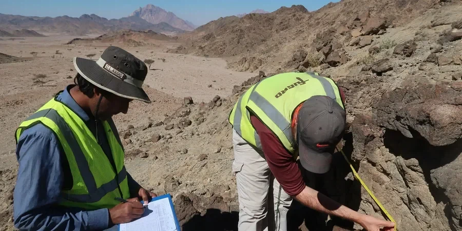
A mid-rise residential development in the Molonglo Valley stalled during detailed design. The structural engineer flagged a concern: the site straddled two distinct geological units mapped on the 1:100,000 sheet, and the default AS 1170.4 site class was clearly inappropriate. That project moved forward only after a targeted seismic microzonation study delineated the boundary between rock and deep alluvial sediments. Canberra sits within a region of moderate seismicity, with the Lake George Fault and Murrumbidgee Fault capable of generating a magnitude 7.0 event. The amplification effects observed in paleochannels beneath the city center demand more than a generic site factor. We run MASW surveys on every microzonation campaign to obtain measured Vs30 profiles rather than relying on proxy correlations, and we integrate seismic refraction data across larger grids where bedrock depth varies abruptly.

Site-specific amplification factors in Canberra paleochannels often exceed the default AS 1170.4 values by 20 to 40 percent, directly impacting base shear demands.

Method and coverage

A common mistake we see in Canberra is treating the entire suburb of Civic or Belconnen as a single site class based on a few boreholes near the lake. The subsurface here is far more complex. Buried Tertiary gravels and interbedded clays create impedance contrasts that trap seismic energy, extending the duration of strong shaking. A proper microzonation study maps these contrasts across the project footprint using a grid of geophysical lines and dedicated boreholes for stratigraphic control. The output is a map of amplification factors, fundamental period contours, and liquefaction susceptibility zones that feed directly into the structural model. When deep soft soils are identified, we often recommend complementing the study with liquefaction assessment using SPT-based triggering procedures from Seed & Idriss, calibrated for Australian conditions.
Seismic Microzonation Studies in Canberra: Site-Specific Hazard Assessment
Technical reference image — Canberra

Regional considerations

The most persistent risk in Canberra is not the earthquake magnitude but the resonance between soft soil deposits and the building stock. Many older masonry structures in the inner north have fundamental periods in the 0.2 to 0.4 second range. The paleochannel sediments west of Northbourne Avenue amplify spectral accelerations precisely in that band. A blanket site class assignment misses this entirely. The 1989 Newcastle earthquake demonstrated how distant events can devastate a city built on unconsolidated sediments. Canberra shares that vulnerability. A microzonation study identifies zones where soil-structure resonance could occur and provides the spectral parameters for a site-specific response spectrum. Engineers then adjust the design base shear accordingly, often adding 15 to 25 percent above the code minimum for critical facilities.

Need a geotechnical assessment?

Reply within 24h.

Email: contact@geotechnicalengineering1.co

Technical parameters

ParameterTypical value
Vs30 measurement methodMASW or downhole seismic (AS 1726)
Seismic hazard source modelGeoscience Australia NSHA 2018
Site classification standardAS 1170.4-2007 Section 3
Ground motion prediction equationsAtkinson & Boore (2006), Somerville et al. (2009)
Minimum survey grid density50 x 50 m for built-up areas
Amplification period range0.1 s to 3.0 s structural period
Liquefaction screening depthTop 20 m as per NCEER guidelines

Complementary services

01

Site-Specific Response Analysis

One-dimensional equivalent linear or nonlinear ground response analysis using DEEPSOIL or STRATA. We input measured Vs profiles and modulus reduction curves calibrated for local soils. Output includes surface acceleration time histories, response spectra at multiple return periods, and amplification factor contours mapped across the development footprint.

02

Liquefaction Hazard Mapping

Integration of SPT, CPT, and Vs data to map liquefaction potential index across the site. We apply the Boulanger & Idriss (2014) CPT-based procedure and the NCEER SPT-based method. Results are presented as GIS-ready layers showing lateral spreading displacement and post-liquefaction settlement estimates for the design earthquake scenarios.

Standards that apply

AS 1170.4-2007 Structural design actions — Earthquake actions in Australia, AS 1726-2017 Geotechnical site investigations, NEHRP Provisions (FEMA P-1050) for site response analysis methodology, Geoscience Australia National Seismic Hazard Assessment (NSHA 2018)

Q&A

Does Canberra really need seismic microzonation given its moderate seismicity?

Yes. While the peak ground acceleration for a 1-in-500-year event in Canberra is lower than Sydney or Newcastle, the site amplification effects in the paleochannels can increase spectral accelerations by a factor of two or more at certain periods. AS 1170.4 requires site-specific studies when site conditions fall outside the standard five site classes, which is common in the Molonglo and Jerrabomberra corridors.

What is the typical cost range for a seismic microzonation study in Canberra?

The cost depends on the site area, survey grid density, and number of boreholes required for stratigraphic control. For a typical residential subdivision or commercial development in Canberra, the range is AU$6,620 to AU$25,930. A detailed quote is provided after reviewing the site location and geomorphological setting.

How many MASW lines are needed for a reliable microzonation?

The minimum for a site smaller than one hectare is three intersecting lines to capture lateral variability. For larger subdivisions, we follow a grid spacing of 50 meters in the built-up area, tightened to 25 meters where the water table is shallow or where paleochannel boundaries are expected. Each line provides a 1D Vs profile that is interpolated across the grid.

What deliverables do we receive from the study?

The report includes a site classification map per AS 1170.4, spectral acceleration contours for structural periods from 0.1 to 3.0 seconds, a liquefaction hazard map, and ground motion acceleration time histories for input into structural analysis software. All data is delivered in digital format compatible with GIS and structural design platforms.

Location and service area

We serve projects across Canberra and its metropolitan area.

View larger map