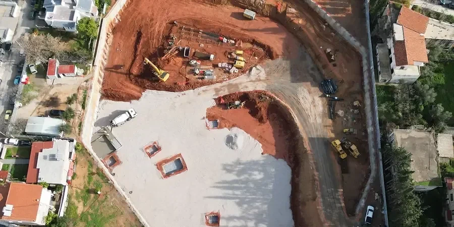
Excavation works in Canberra represent a critical phase in the lifecycle of urban development, infrastructure upgrades, and resource projects. The category encompasses all activities related to the controlled removal, displacement, and management of soil and rock to create foundations, tunnels, basements, and service trenches. In a city defined by its planned landscape and growing population, the importance of technically sound excavation cannot be overstated. Poorly executed earthworks can lead to ground instability, damage to adjacent structures, and significant safety hazards. This pilar page serves as a comprehensive guide to the geotechnical principles, local geological challenges, and regulatory frameworks that govern excavation projects across the Australian Capital Territory.
Canberra's subsurface conditions are far from uniform, presenting a complex interplay of geology that directly influences excavation methodology. Much of the city is underlain by the Canberra Formation, comprising steeply dipping, folded, and faulted Ordovician to Silurian age sedimentary rocks such as sandstone, siltstone, and mudstone, often deeply weathered to a stiff clay. Overlying these residual soils are Quaternary alluvial deposits in the major creek corridors and the Molonglo River floodplain, which consist of unconsolidated sands, silts, and clays with variable groundwater conditions. The presence of deeply weathered zones, reactive clays, and isolated igneous intrusions demands a rigorous site-specific geotechnical investigation before any excavation design can be finalized. Understanding these local conditions is essential to selecting appropriate support systems and dewatering strategies.
Any excavation project in Canberra must strictly adhere to a hierarchy of national and local regulations designed to ensure public safety and structural integrity. The primary standard is AS 4678-2002 for earth retaining structures, which provides design requirements for both temporary and permanent works. This is complemented by the National Construction Code (NCC), which adopts AS 1170 for structural design actions, and the Work Health and Safety Act 2011 (ACT), which mandates a safe work method statement for any excavation deeper than 1.5 metres. Local technical guidance is also available through Transport Canberra and City Services (TCCS) for works within the public right-of-way. The geotechnical design process must explicitly consider these standards, particularly the limit state design philosophy of AS 4678, to manage risks associated with ground collapse and wall failure.
The types of projects that rely on advanced excavation expertise in Canberra are diverse and technically demanding. The construction of multi-storey commercial basements in the city centre often requires geotechnical design of deep excavations using anchored or strutted retaining walls to protect neighbouring heritage-listed buildings. Major infrastructure initiatives, such as the light rail network extensions, involve cut-and-cover tunnels and station boxes where geotechnical analysis for soft soil tunnels is paramount to control surface settlement. Utility-scale earthworks for new suburban developments demand careful sequencing and compaction control. Throughout these projects, geotechnical excavation monitoring provides the real-time data needed to verify design assumptions and trigger contingency measures if ground movements exceed predetermined thresholds. Each of these applications underscores the need for a specialized, integrated approach.
The main risks stem from Canberra's varied geology, including the collapse of deeply weathered, low-strength rock in the Canberra Formation and instability in unconsolidated alluvial sands and silts near waterways. High groundwater tables in the Molonglo floodplain can cause base heave or piping. Reactive clay soils also pose a shrink-swell hazard that can affect the long-term performance of retaining walls, making rigorous site investigation and monitoring essential.
AS 4678-2002, 'Earth-retaining structures', is the paramount standard. It establishes the limit state design criteria for both temporary and permanent retaining walls, covering stability, strength, and serviceability. Compliance with this standard, along with the loading codes in AS 1170, is mandatory for all engineered excavations in the ACT to ensure they safely resist ground and water pressures.
Under the Work Health and Safety Act 2011 (ACT), any excavation with a depth greater than 1.5 metres is considered high-risk construction work. This triggers a legal requirement for a Safe Work Method Statement (SWMS) to be prepared before work commences. The SWMS must identify all hazards, including ground collapse and falling objects, and detail the specific control measures to be implemented.
Real-time geotechnical monitoring uses instruments like inclinometers, surface settlement points, and piezometers to continuously track ground movement and water pressure during excavation. This data allows engineers to immediately compare actual performance against the design predictions. If movements approach a predefined trigger level, work can be paused and contingency measures enacted, preventing structural damage or catastrophic failure.